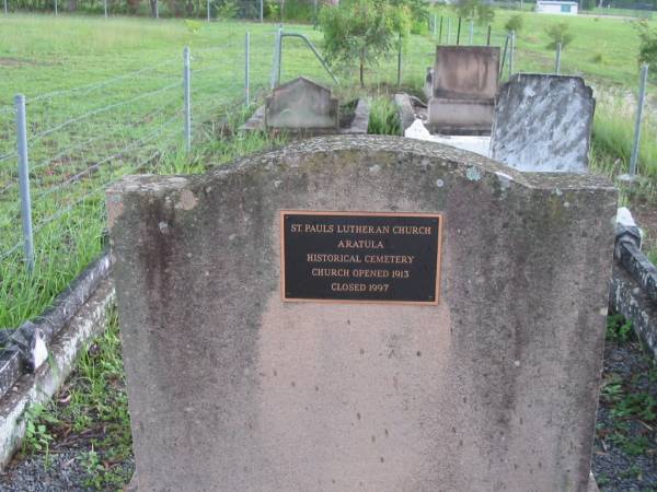
St Pauls Lutheran Church Aratula
Historical Cemetery
church opened 1913, closed 1997
St Paul's Lutheran, Aratula, Boonah Shire
All the headstone photos in
Aratula Lutheran, Boonah Shire
Names in photographed order.
Names in alphabetical order.
Latitude -27.98111017067564, Longitude 152.5421224357739
Latitude -27° 58’ 52", Longitude 152° 32’ 32"
GoogleMap
or GoogleEarth map application for Aratula Lutheran, Boonah Shire. (What's this?)
All the cemeteries
© Copyright 1996-2026 Kerry Raymond and David Horton
`
