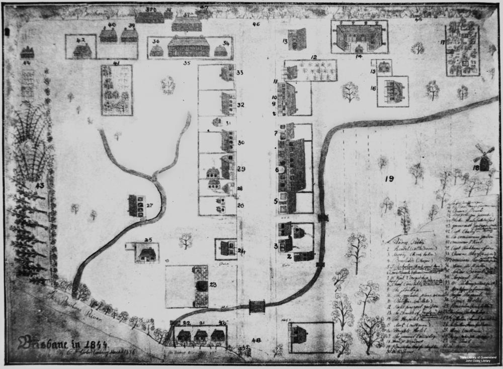
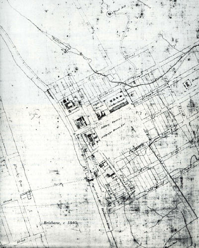
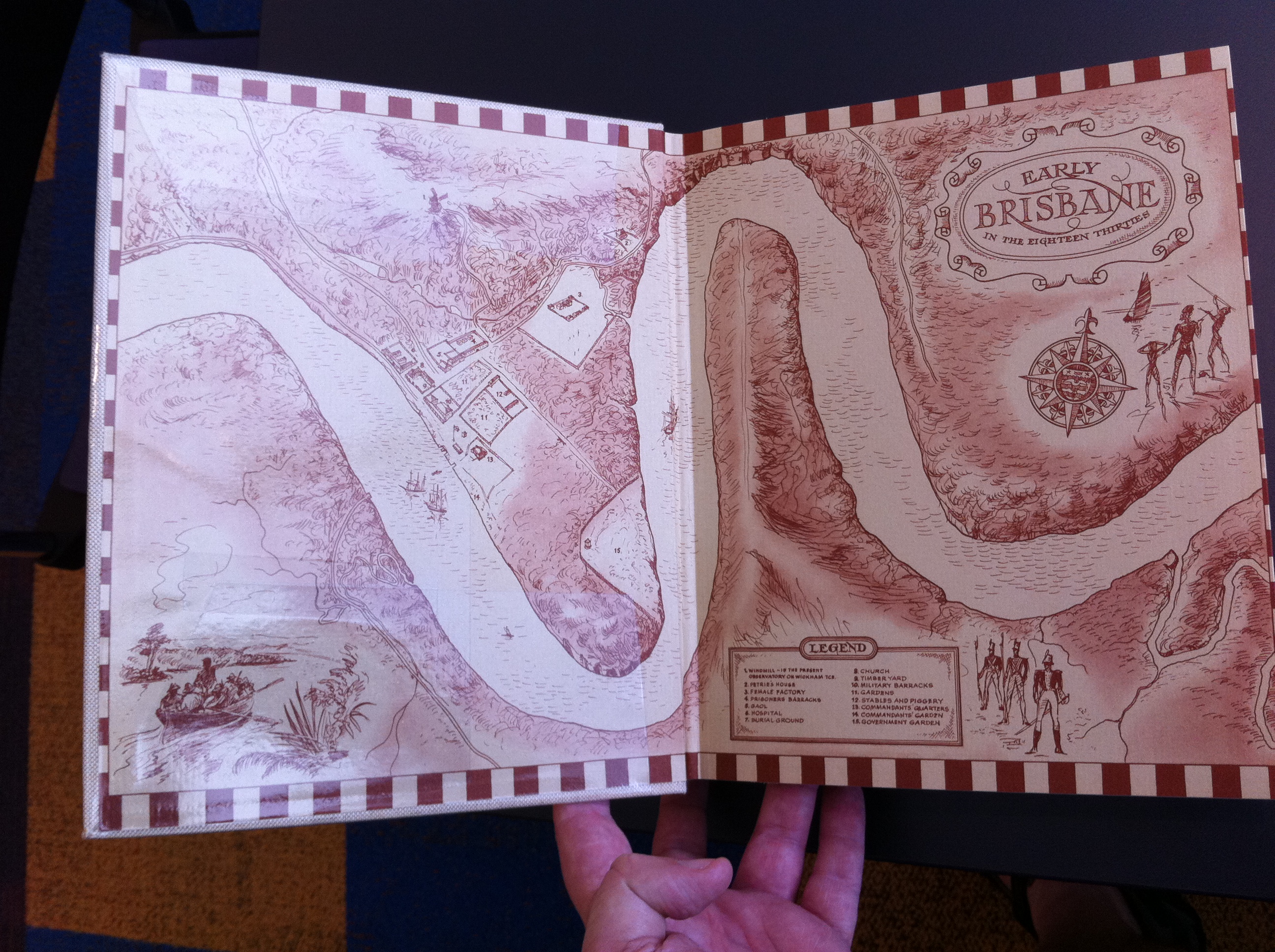
Brisbane 1844. (Is that really 1833?)
1 (lower centre right) Andrew Petrie
17 (top right) The General Cemetery
48 (top right (left of 17)) The First Tombstones (two graves)
18 (centre right) Tread and windmill
37 (top centre) Commission Stores
43 (left) Government gardens
46 (centre running top to bottom) Queen Street
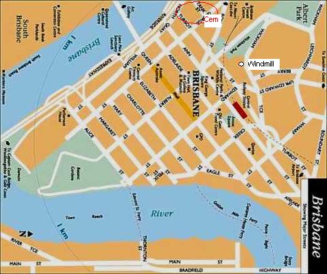
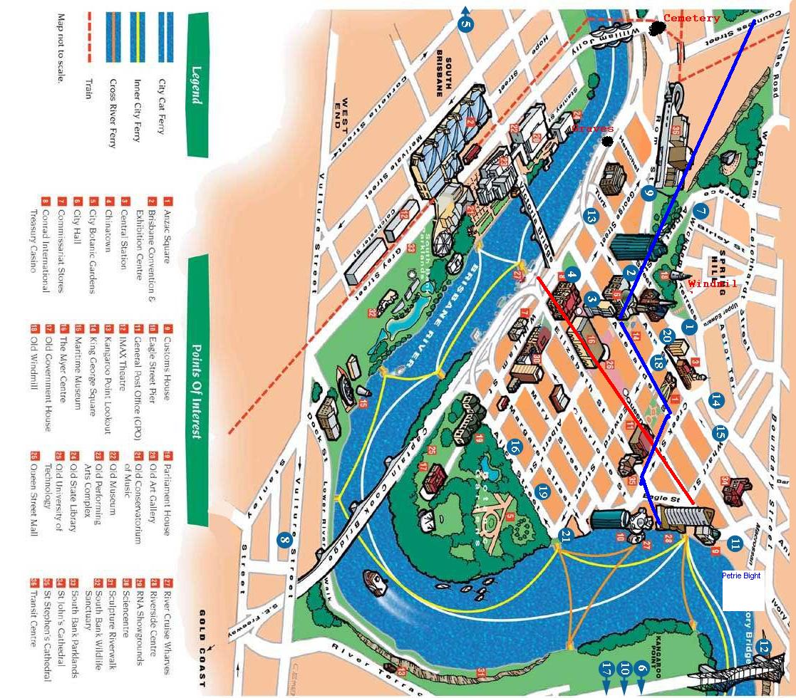
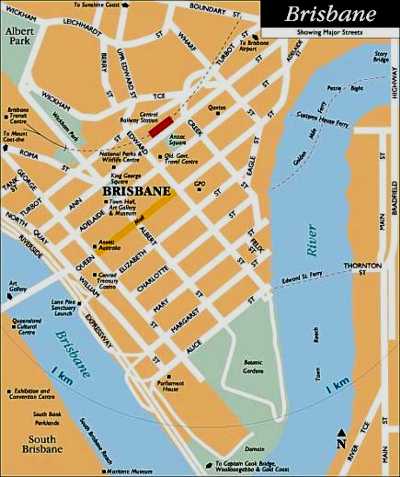
Queen Street exists today, as the darker orange.
The windmill from 1844 still exists and is found in the kink in Wickham Tce.
Creek street today follows a similar alignment to creek in the foreground, presumably following the lower lying land that is Adelaide street through the bog that is King George Square today, continuing along Roma street.
The original North Quay (General Cemetery) was described as being "on the bank of the river on the curve of North Quay".
(Perhaps off the top of this modern map),
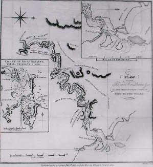
Compare to Brisbane 1844 (1833) map
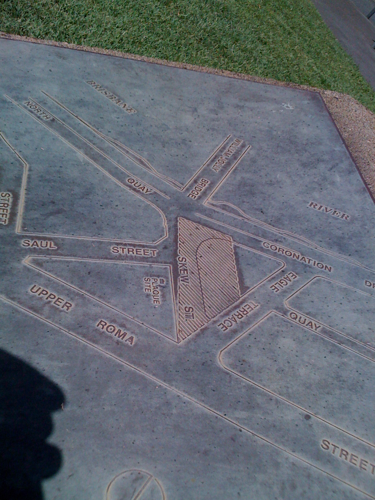
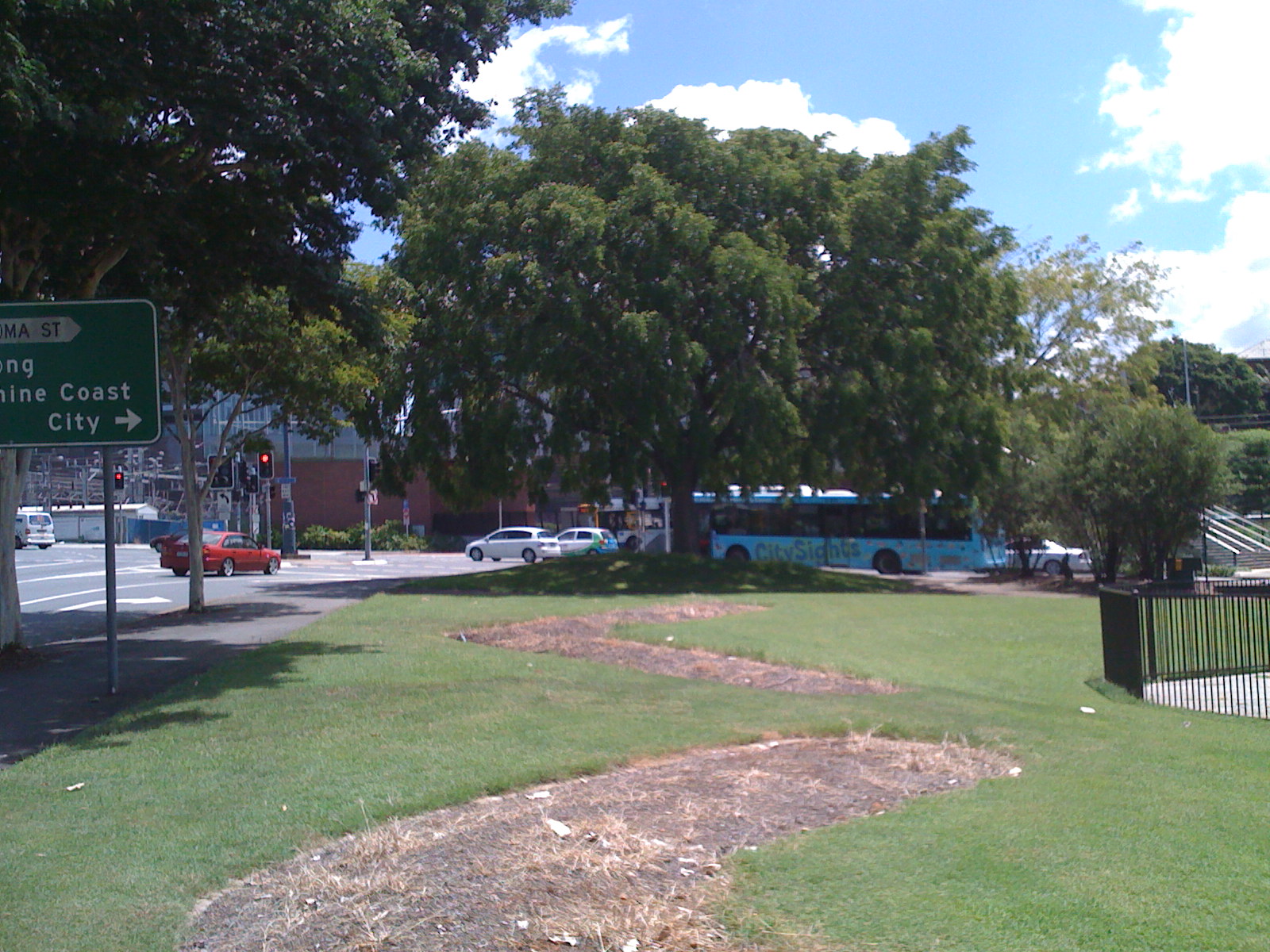
Approx location of General cemetery near Skew street at end of William Jolly bridge
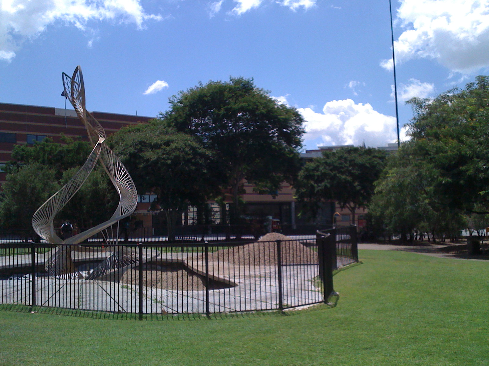
Approx location of early graves near Herschel street.
Windmill and Commissariat Stores remain.
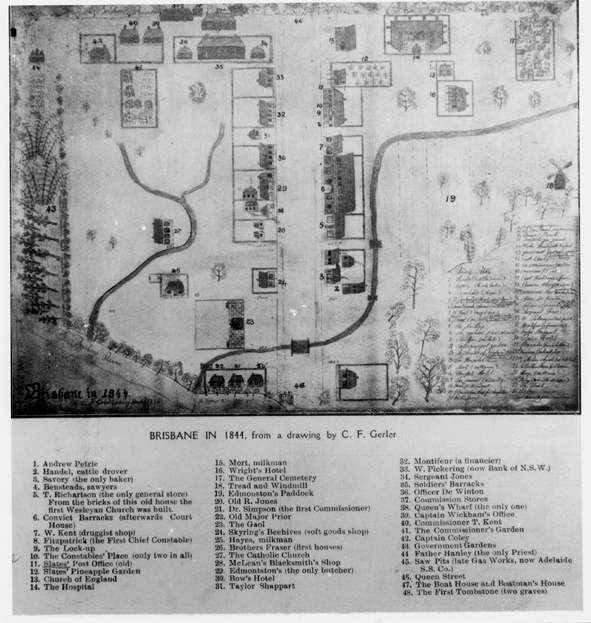
Brisbane 1840 Plan Martens
(top to bottom)
Windmill
Ann Street
Adelaide Street
(Queen?) Street
(Elizabeth) Street
Charlotte Street
Mary Street
Margaret Street
--
(right to left)
Edward Street
Albert Street
(George) Street
William Street
ferry? to
Stanley Quay
Brisbane 1844. (Is that really 1833?)
1 (lower centre right) Andrew Petrie
17 (top right) The General Cemetery
48 (top right (left of 17)) The First Tombstones (two graves)
18 (centre right) Tread and windmill
37 (top centre) Commission Stores
43 (left) Government gardens
46 (centre running top to bottom) Queen Street
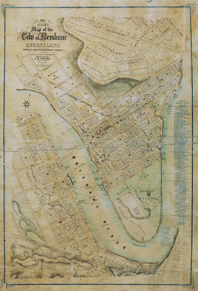
Brisbane 1863 - Ham's map of the city of Brisbane
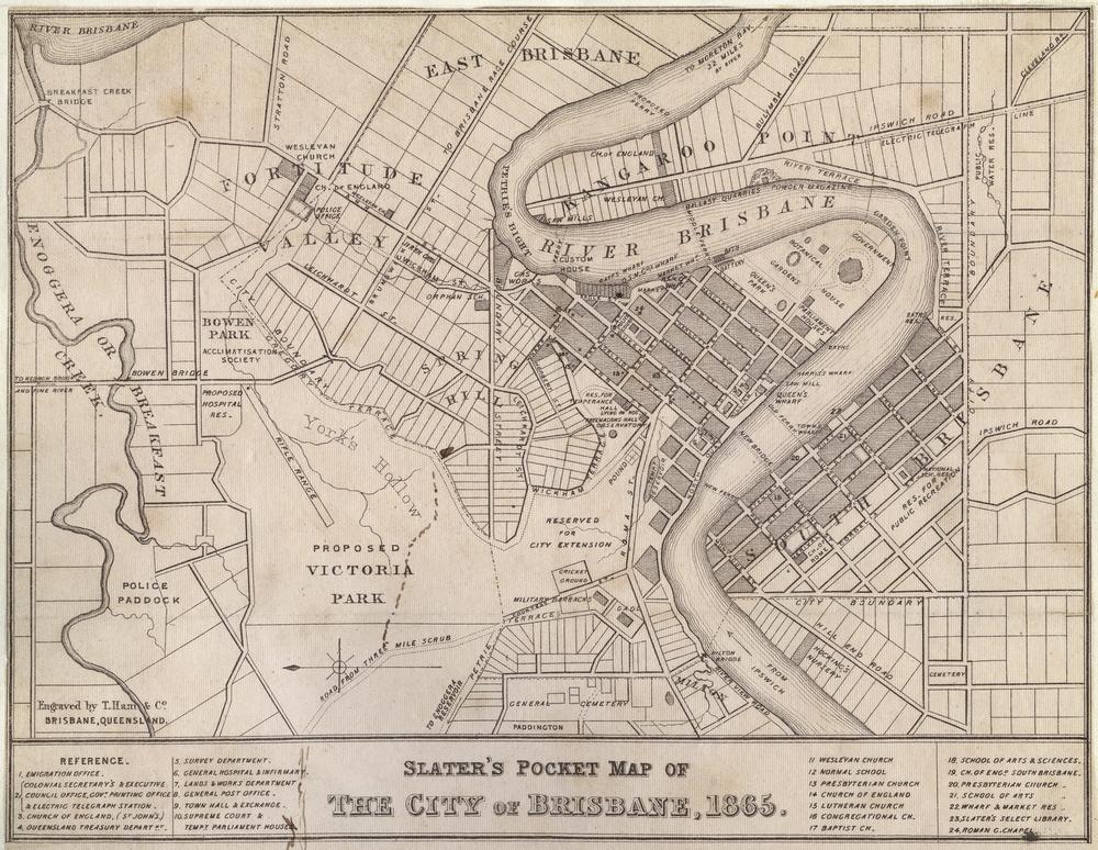
Brisbane 1865 - Slater's pocket map of the City of Brisbane.
Paddington "General Cemetery"
West End Cemetery.
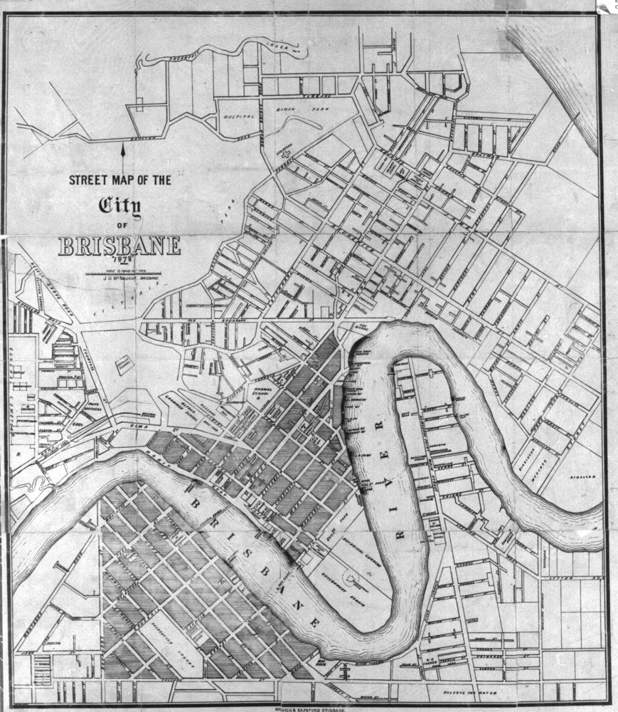
Brisbane 1878
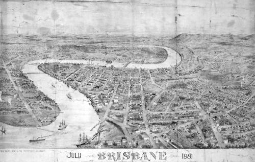
Brisbane 1881 - Martens
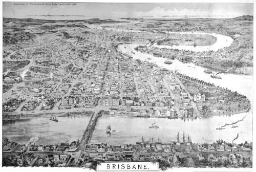
Brisbane 1886 Martens
Brisbane 1918
Brisbane 2000
Brisbane 1844 Martens
Paddington cemetery on left (with creek to south)
West End/South Brisbane cemetery just in on lower left corner
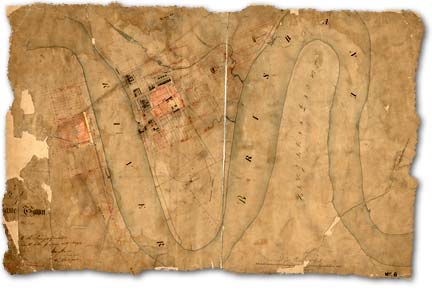
Brisbane 1842 - Shows settlement at South Brisbane
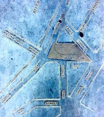
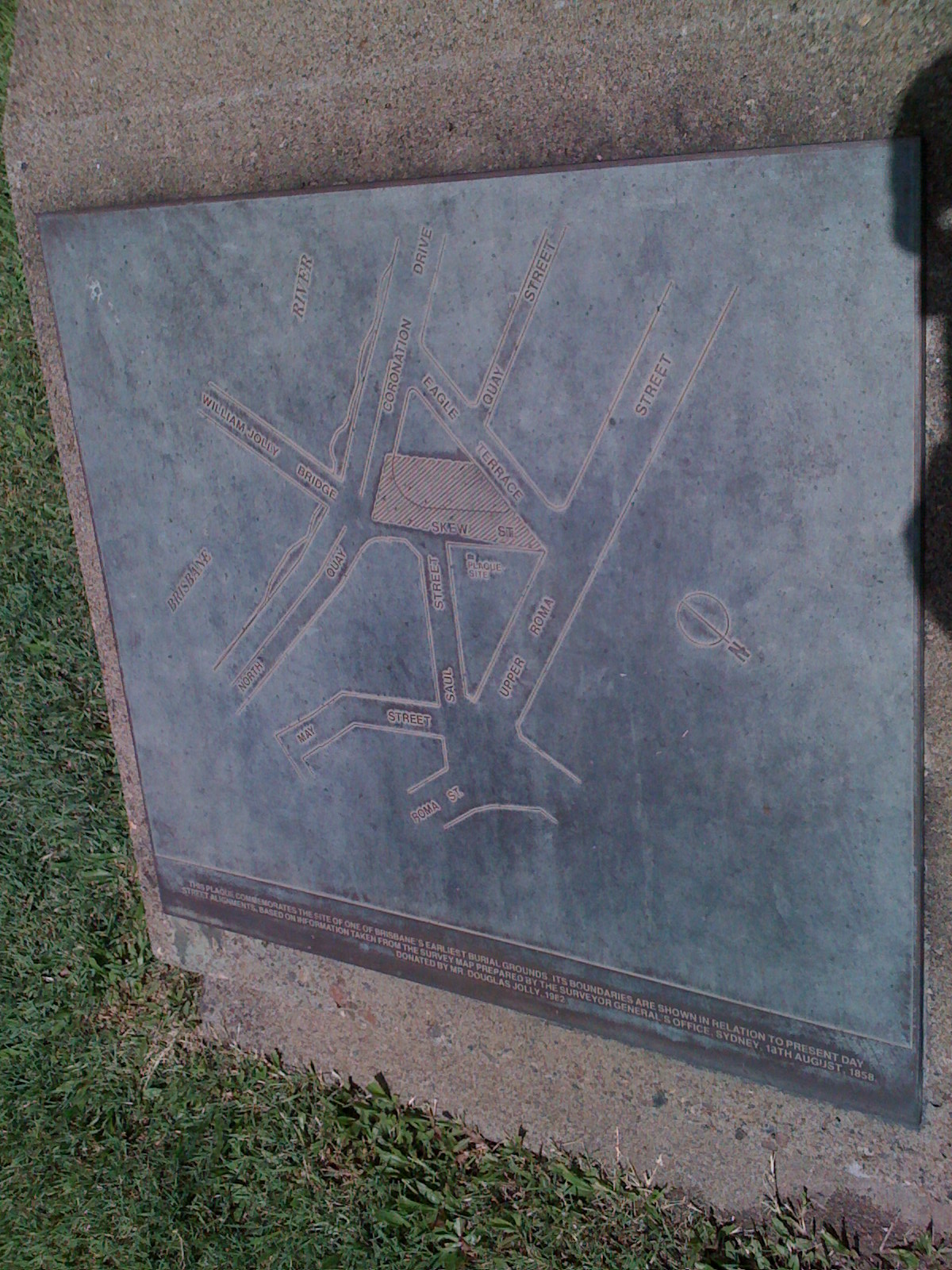
North Quay Cemetery as surveyed 1858
North Quay Cemetery as surveyed 1858
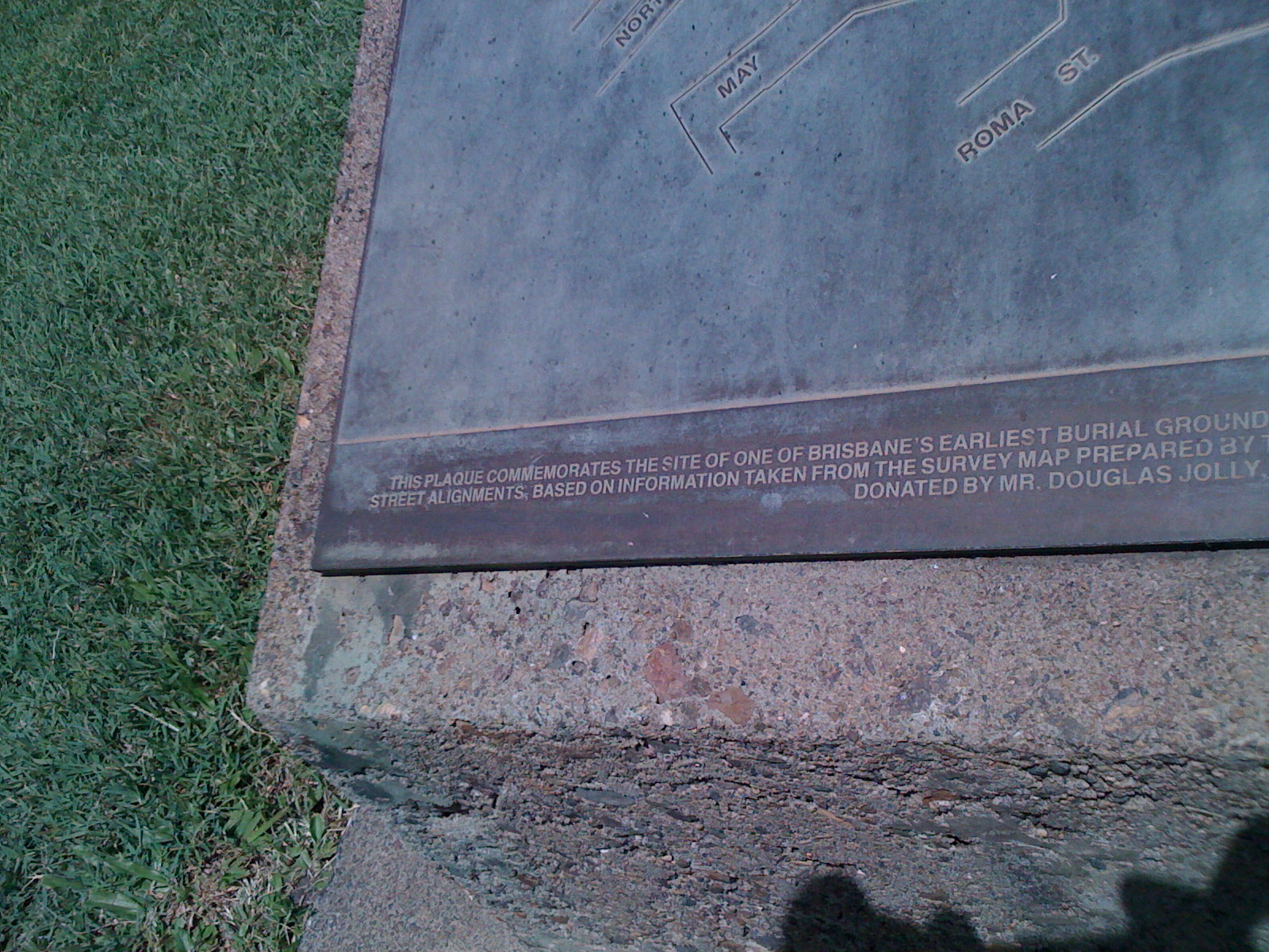
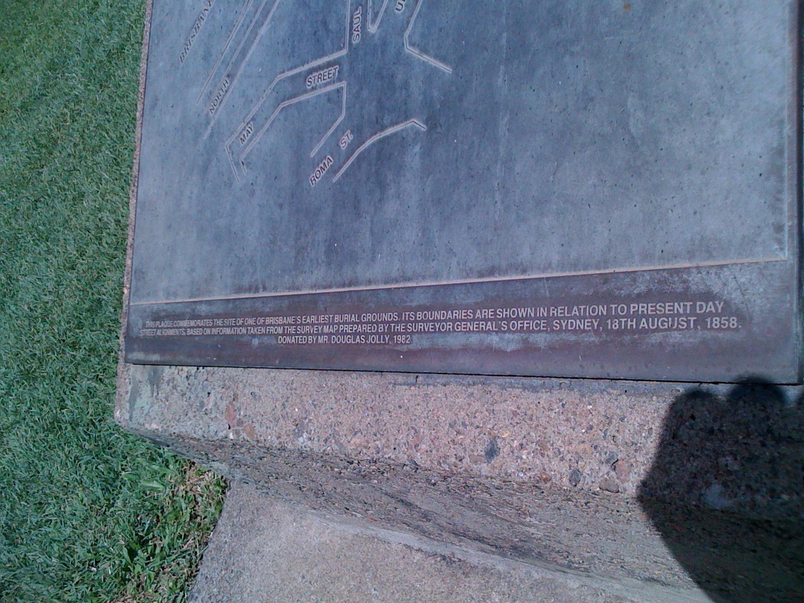
This plaque commemorates the site of one of Brisbane's earliest burial grounds. Its boundaries are shown in relation to present day street alignments based on information taken from the survey map prepared by the surveyor general's office, Sydney, 18th August, 1858. Donated by Mr Douglas Jolly, 1982.
North Quay Cemetery as surveyed 1858
North Quay Cemetery as surveyed 1858
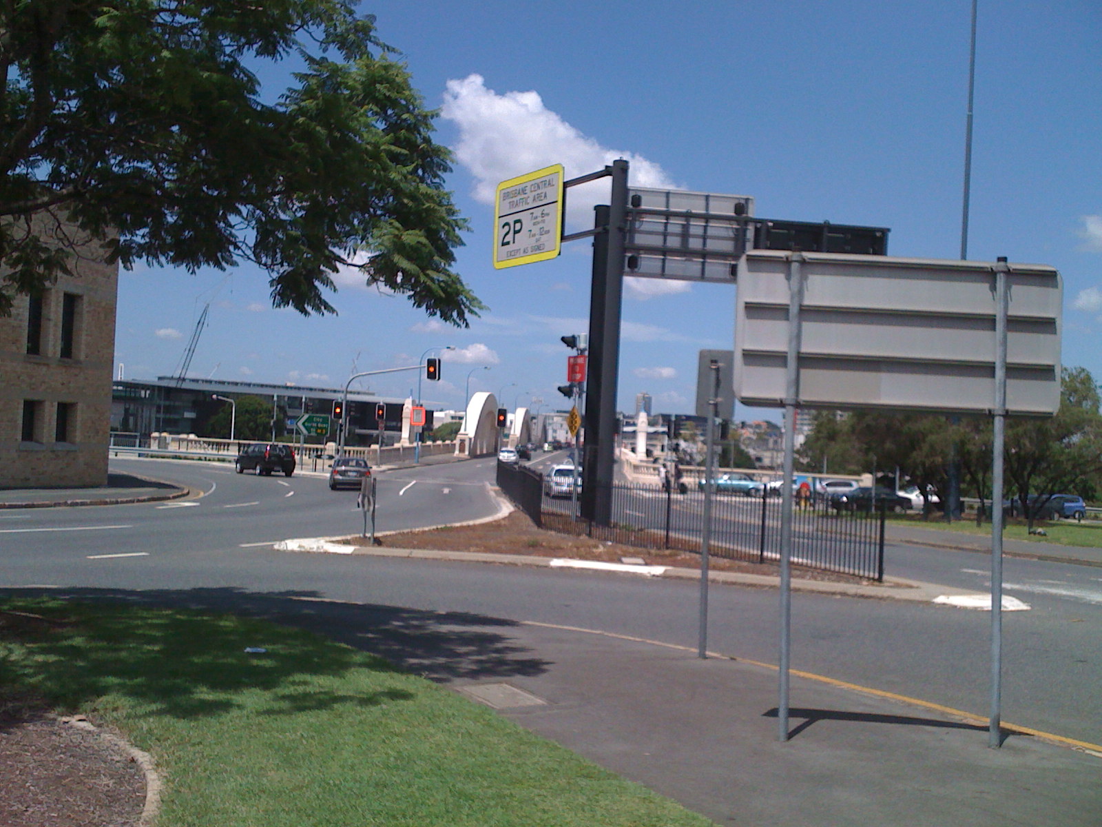
William Jolly Bridge
North Quay Cemetery as surveyed 1858
Skew St Cemetery original location
North Quay Cemetery as surveyed 1858
North Quay Cemetery as surveyed 1858
North Quay Cemetery as surveyed 1858
North Quay Cemetery as surveyed 1858
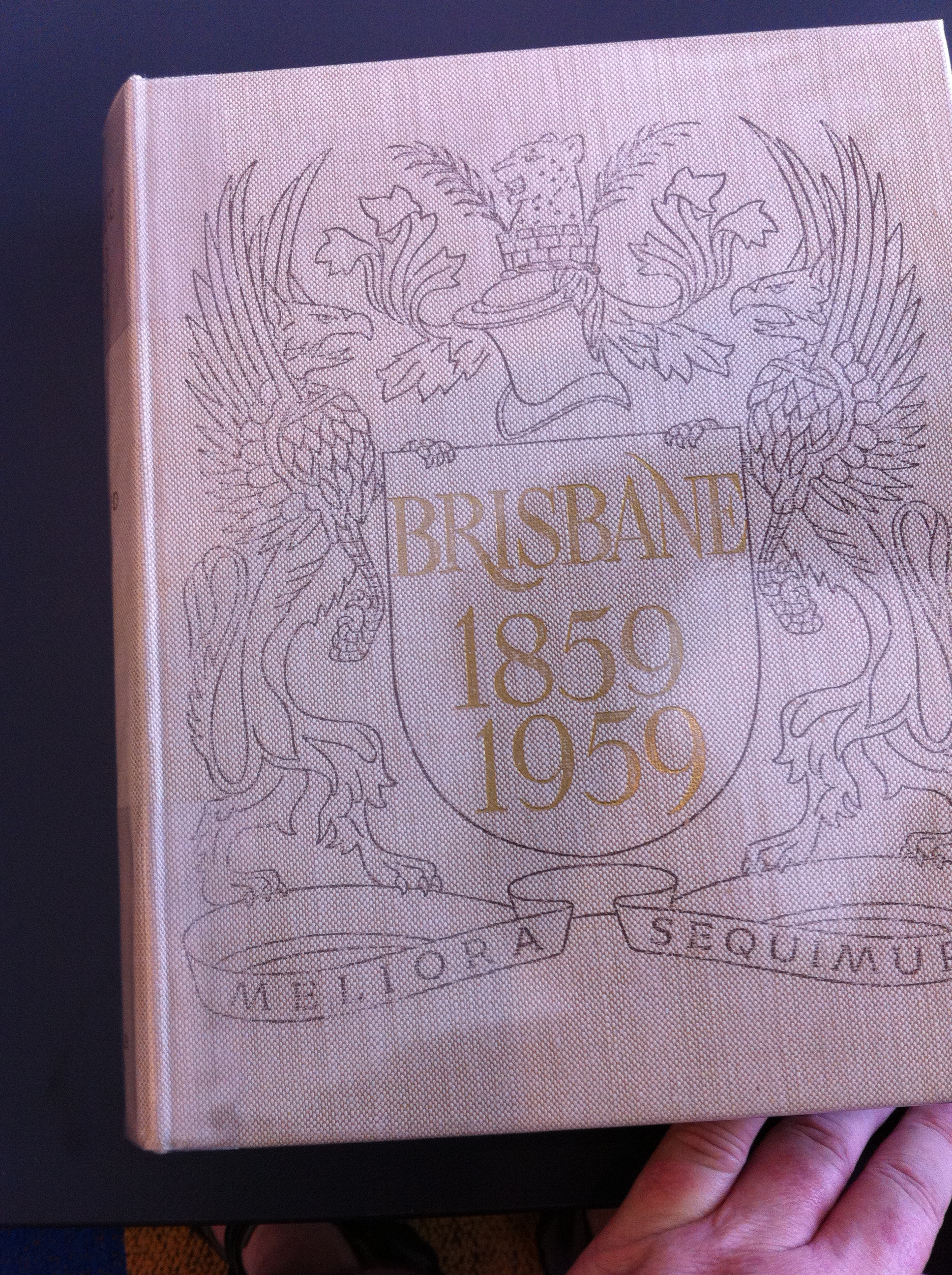
From "Brisbane 1859-1959"
Brisbane City Council Library
From "Brisbane 1859-1959"
Brisbane City Council Library
Notice cemetery top left.
Brisbane - John Oxley map
| Name | Died | Where Buried |
|---|---|---|
| Stapylton | bef 1841 | North Quay |
| Tuck | bef 1841 | North Quay |
| Dunlop | abt. 1895 | elsewhere |
| Merridoo | abt 1841 | Nearby North Quay |
| Noogamill | abt 1841 | Nearby North Quay |
An earlier grave site was on the riverbank just downstream (between Herschel St and Tank St). (It was used for children because the general cemetery was not suitable.)
Bodies were exhumed and transferred to Brisbane General Cemetery, Toowong in 1881
More information about
Toowong Cemetery history including history of earlier cemeteries.
The Paddington Cemetery (as described 1907)
CEMETERY AT NORTHERN APPROACH TO WILLIAM JOLLY BRIDGE :
Letter of protest against land between Eagle Terrace and Union Street being used for
drainage purposes. Mentions land having been used for cemetery purposes in the past.
THE OLD BURIAL GROUND. (1913, October 7). The Brisbane Courier (Qld. : 1864 - 1933), p. 4. Retrieved February 11, 2012, from http://nla.gov.au/nla.news-article19907521
Historic Brisbane maps from Picture Queensland from State Library of Queensland.
State Library of Queensland: Slater's Pocket Map of the City of Brisbane, 1865 or Trove
Brisbane 1844 Martens
Street map of the city of Brisbane, Queensland, 1878 from John Oxley Library, State Library of Queensland.
Map of Brisbane, 1844 Gerler, Carl Friedrich from John Oxley Library, State Library of Queensland,
Ham's map of the city of Brisbane, Queensland, 1863 from John Oxley Library, State Library of Queensland,
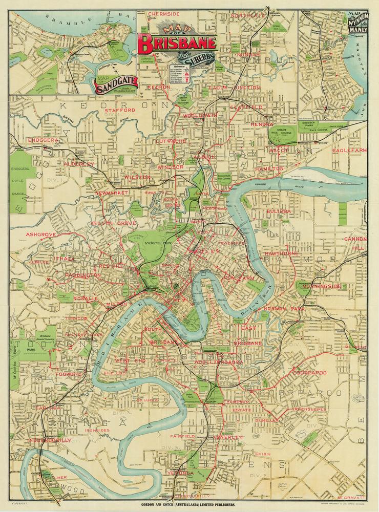
Map of Brisbane and suburbs (Gordon & Gotch) from State Library of Queensland,
Photographed: Plaque Feb 2009