Upper Caboolture Uniting (Methodist) cemetery, Caboolture Shire
All the headstone photos in
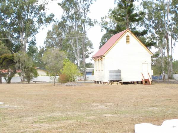
Upper Caboolture Methodist Church
Names in photographed order.
Names in alphabetical order.
Latitude -27.10712172411755, Longitude 152.8945391400182
Latitude -27° 6’ 26", Longitude 152° 53’ 40"
GoogleMap
or GoogleEarth map application for Upper Caboolture Methodist Church. (What's this?)
All the cemeteries
© Copyright 1996-2026 Kerry Raymond and David Horton
`
